ROSEDALE · ABOUT 6 KM SOUTH-EAST · COAL, GRAIN AND RAIL
Crossing the Star Mine suspension bridge
A narrow footbridge sways over the Red Deer River at Rosedale. It was built for miners walking to work, and it still carries you from a quiet hamlet to the foot of the badlands.
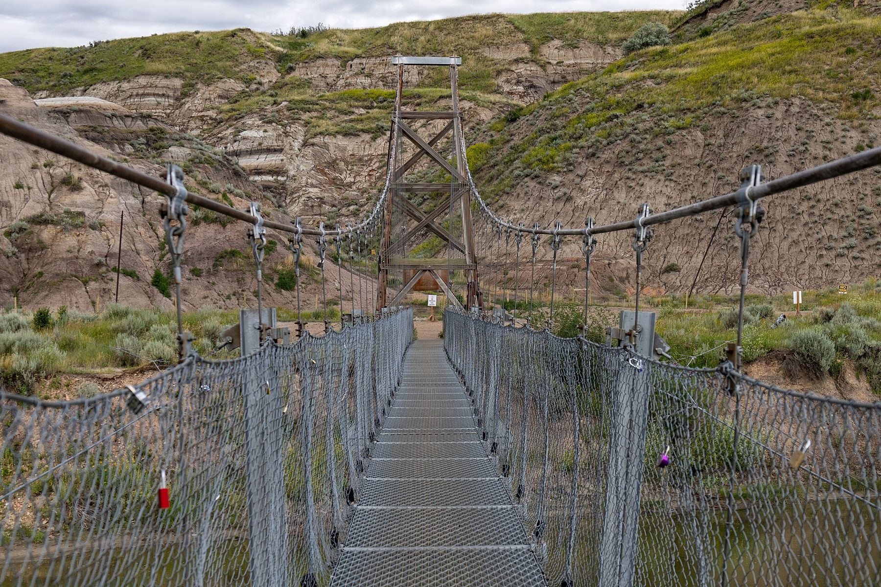
Rosedale is a small place on Highway 10, a few minutes south-east of Drumheller, where the valley narrows and the road runs close to the Red Deer River. A short turn off the highway leads to a gravel parking area, a patch of trees and a slender bridge of cable and steel mesh slung across the brown water. On the far side, the badlands rise almost straight from the bank. This is the Star Mine Suspension Bridge, and for most of its life it was simply the way to work.
A path to the far bank
In the years when coal ran the valley, Rosedale was a mining town and the Star Mine worked the seams on the other side of the river. Miners lived on one bank and worked on the other, and the river was in the way. A boat could be used in calm weather, but the Red Deer rises in spring, runs fast after storms and freezes in winter. A fixed crossing was the answer, and a footbridge was the cheapest one that would work.
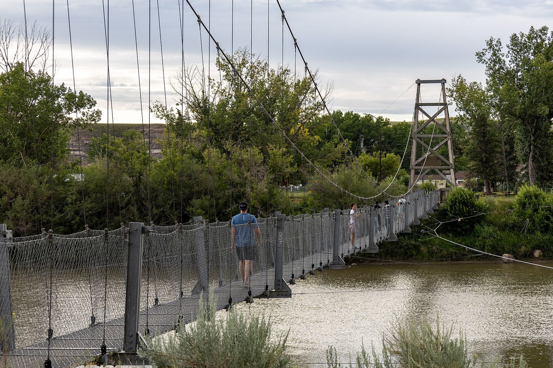
The first suspension bridge here dates from the early 1930s. It was later rebuilt and strengthened, and the structure you walk on today has been repaired and updated more than once since the mine closed. The tall towers at each end hold the main cables; the deck hangs from them on thin vertical rods. Mesh sides keep you from slipping through. The design is simple, and you can see every part of it as you walk.
How the deck moves underfoot
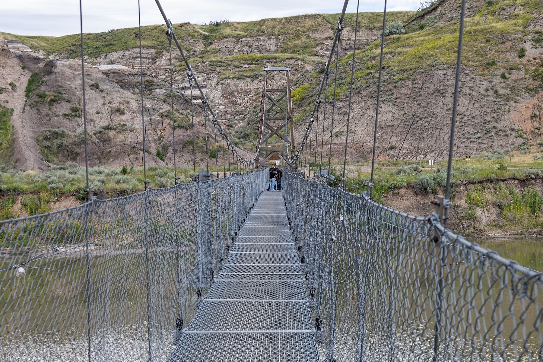
The bridge is more than a hundred metres long, and it is meant to move. When one person walks, it barely stirs. When a group crosses, or when children decide to bounce, the deck rises and falls in slow waves and sways gently from side to side. Most people find this more amusing than alarming, but if you are unsure of heights or open water, cross when it is quiet and keep a hand on the cable rail.
Halfway across, stop and look both ways along the river. Upstream, the valley bends toward Drumheller between grey and brown slopes. Downstream, it continues toward the hoodoos and East Coulee. The water is usually brown with silt from the soft rock it cuts through, and the current is steady even when it looks slow. Cottonwoods line the banks, and swallows often work the air above the water in summer.
You may notice padlocks clipped to the mesh, left by visitors.
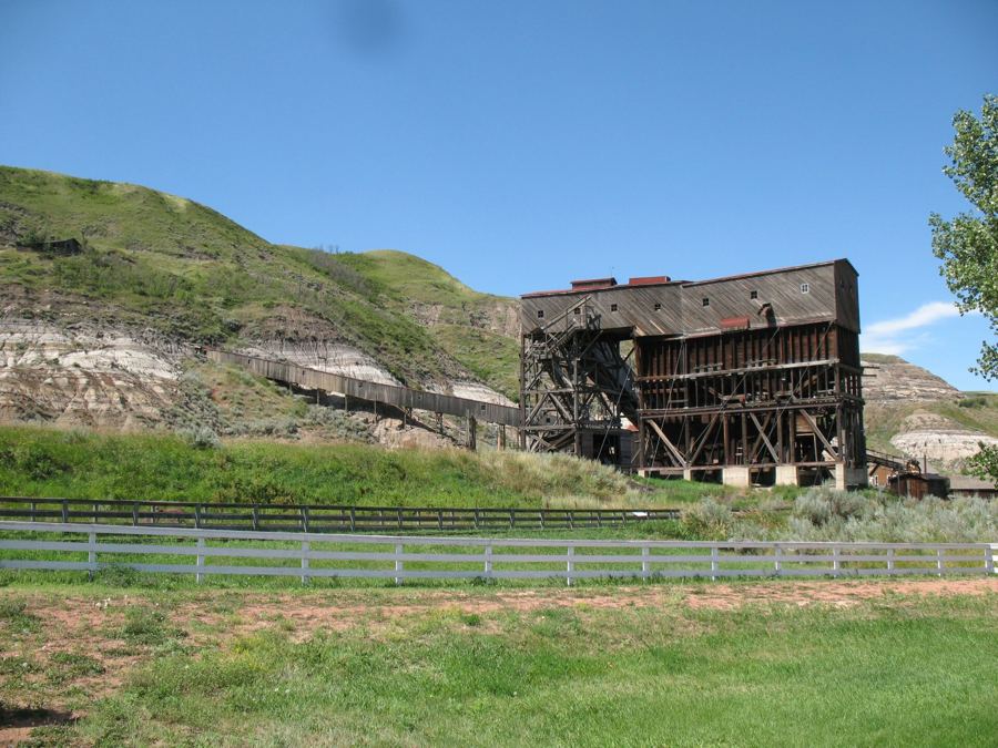 Further along the horizon · About 20 km south-eastAtlas Coal Mine: what the tipple did
What waited on the other side
On the far bank, the ground climbs quickly into the hills. Little remains of the Star Mine to an untrained eye, but you can still find traces of the old workings: flattened ground where buildings stood, a few timbers, darker spoil on the slopes and faint tracks running up the hillside. Old mine openings in the valley were sealed long ago, and the slopes can be loose and unstable, so treat it as a place to look rather than to scramble.
Paths lead a short way up and along the slope, and the view back over the bridge and the trees of Rosedale is worth the short climb. The banded rock here is the same Horseshoe Canyon Formation that runs through the whole valley, with dark seams of coal between paler layers of sandstone and clay. Those seams are the reason the town and the bridge exist at all.
Miners lived on one bank and worked on the other, and the river was in the way.
Coal towns along the valley
Rosedale was one of a string of mining towns along this stretch of the Red Deer. Drumheller grew fastest, but every few kilometres there was another camp or company town, each built around a mine, a tipple and a rail siding. Some, like Rosedale and East Coulee, survive as small communities. Others, such as Nacmine and Midlandvale near Drumheller, have been absorbed into the town or have all but disappeared.
The mines closed through the 1950s, 1960s and 1970s as homes and railways switched to oil and gas. Workers moved away, schools emptied and businesses shut. What remains is scattered: a few old houses, the odd foundation, rail grades now used as paths, and buildings saved by local effort. Further down the valley, the Atlas Coal Mine at East Coulee preserves a full tipple and mine yard and explains how the work was done.
Rosedale and the road south
Rosedale is also where Highway 10X turns south up the valley of the Rosebud River toward Wayne, crossing that small river again and again on a series of narrow bridges. If you have time, combine the two: walk the suspension bridge, then drive the eleven bridges to Wayne and back. Allow an hour or two for both, more if you stop often.
- Facilities at the bridge are basic; plan ahead.
- The bridge may close for repairs or high water.
- Dogs and small children need close attention on the moving deck.
- Watch for traffic when turning on and off Highway 10.
When the valley is quiet
Midsummer afternoons bring the most visitors and the most heat. Early morning and evening are calmer, the light on the far slopes is softer, and you are more likely to have the bridge to yourself. In spring the river runs high and fast, and the cottonwoods along the banks come into leaf. Autumn turns the trees gold against the grey hills. In winter the valley is still and cold, and the bridge can be icy; take care, or enjoy the view from the bank.
Whatever the season, the crossing takes only a few minutes. It is worth doing slowly, though, and worth thinking about the people who walked it twice a day, in the dark and the cold, to reach the coal.